Objective:
- The potential for implementing superblocks given the street network topology for different urban morphologies is equally unclear
- Provide a first exploration of the potential of the superblock concept with the help of automated geospatial analysis
Case:
- Global cities (most are C40)
Methodology:
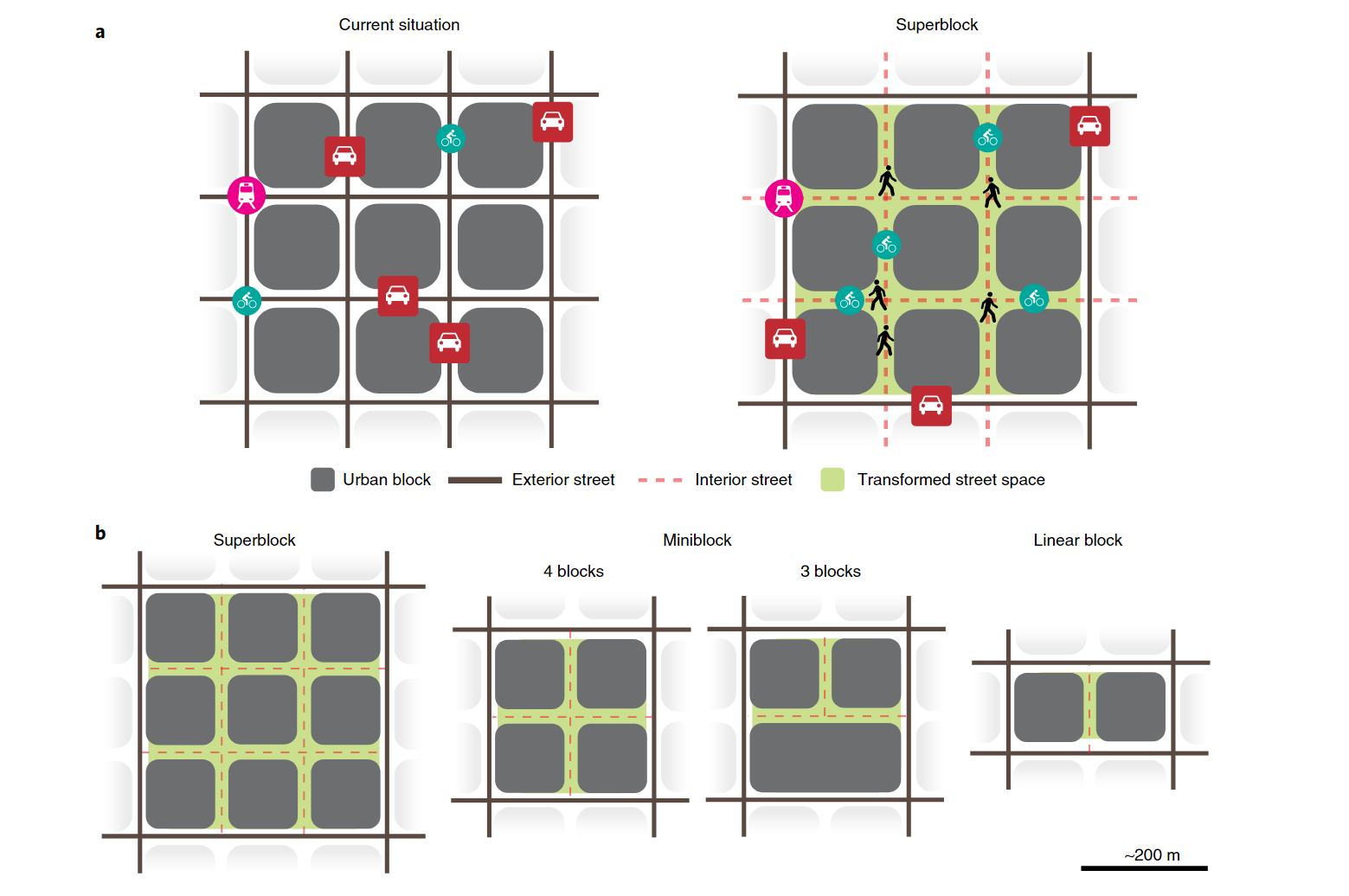
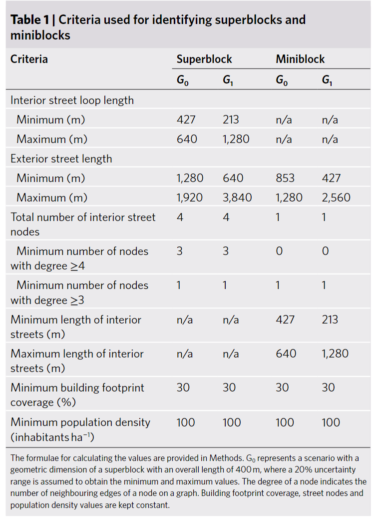
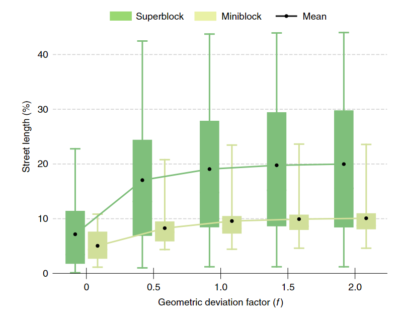
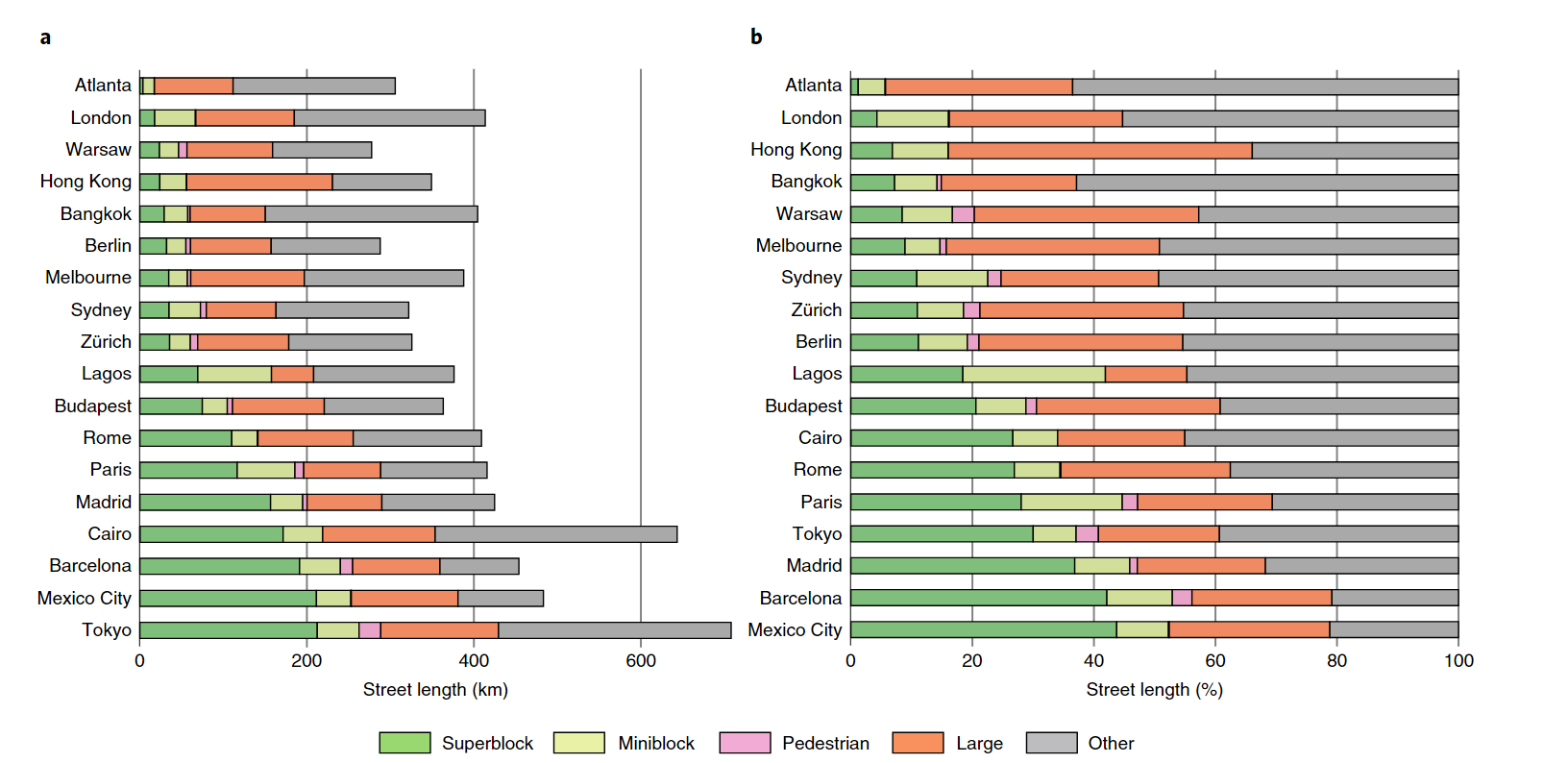
- Superblocks: diversity and density
- Edmonds-Karp and Ford-Fulkerson algorithm: the importance of each network edge (flow)
- Geometric scenario calculation
- NDI: relative importance
Data Source: partial open
- Street network, building footprint: OSM
- Population density: Center for International Earth Science Information Network and Meta
Findings:
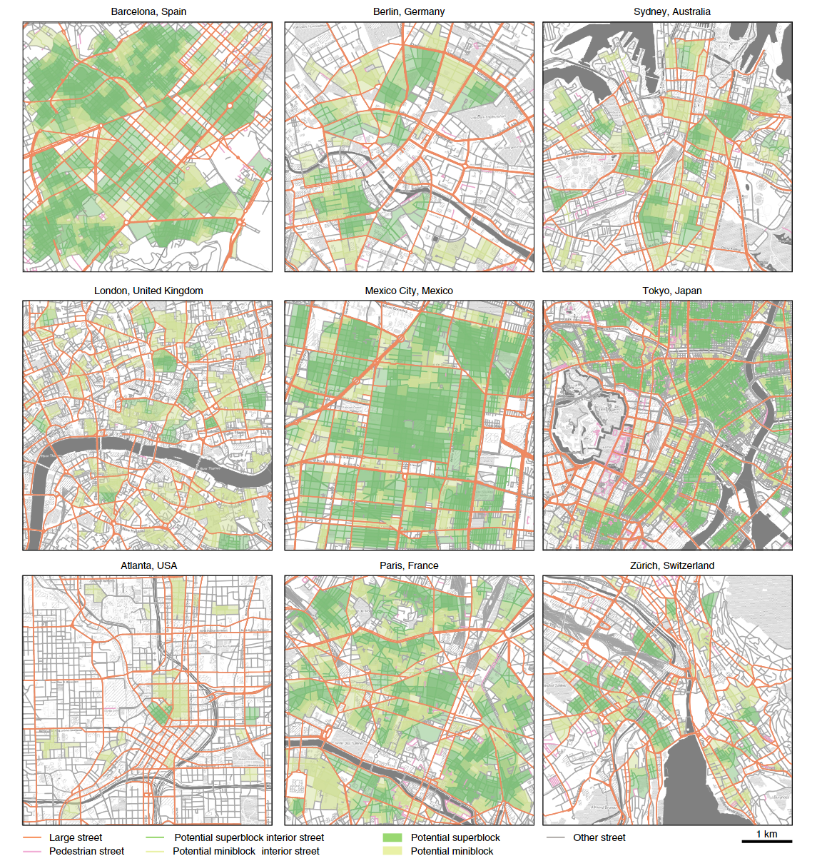
- The share of pedestrian streets is typically only a few percent
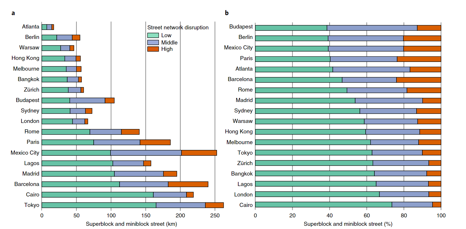
- The streets falling into the lowest NDI class, which is considered to have the least disruption effects
- Across cities with a high share of streets having low NDI values such as London, Cairo and Bangkok, there is a high potential to transform neighborhoods with only limited impacts on traffic flow
- Consumption of people living in poverty is associated with an especially small part of carbon emissions
- Poverty alleviation is possible with minor increases in global carbon emissions
Coding Reference:
