Objective:
- Investigate building data completeness and inequality in OSM on the global scale for 13,189 urban centres around the world
Case:
Methodology:
- Random forest
- Generalized additive models
- K-means
Data Source
- GHS-UCDB
- Building in OSM and Microsoft
- Geo-Wiki
- Population
- Road length
- Waterbody
- Fossil fuel consumption
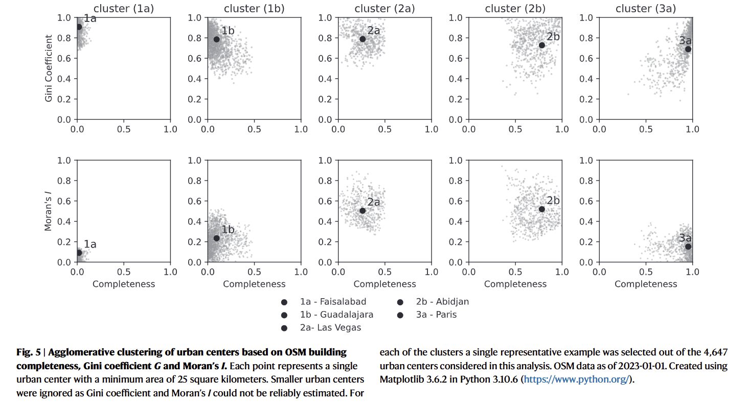
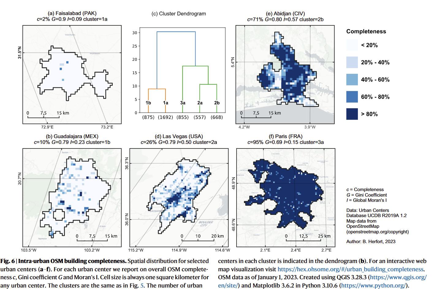
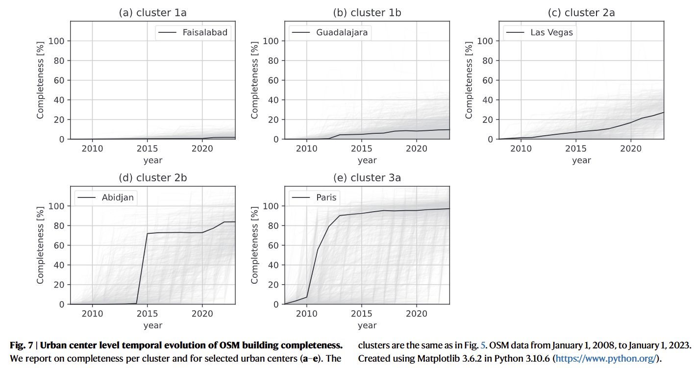
Findings:
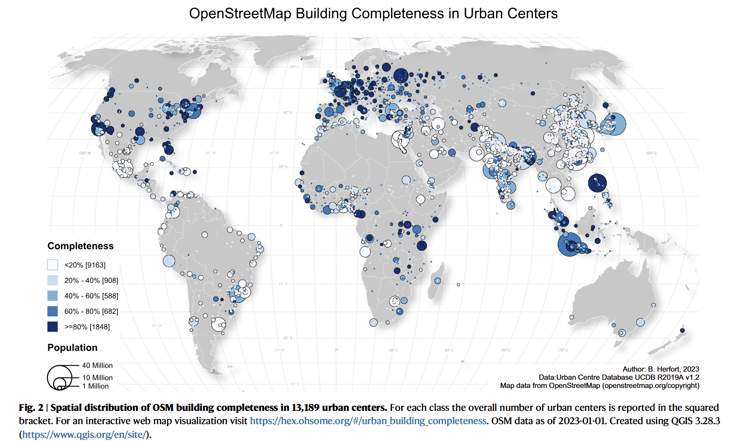
- For 14% cities, OSM building footprint data exceed 80% completeness, while 69% cities do not reach 20% completeness
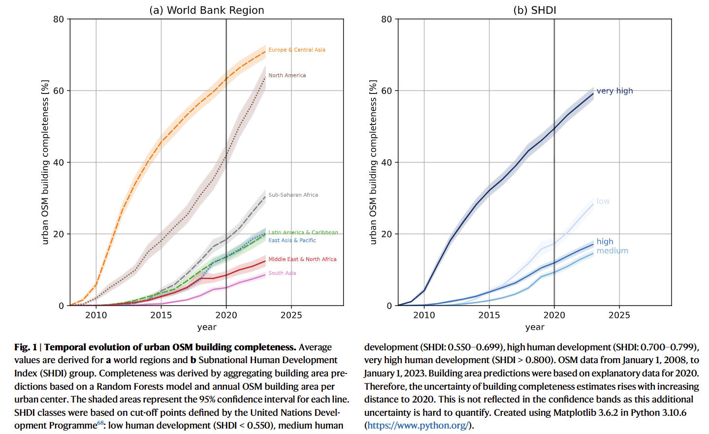
- Humanitarian mapping activities in urban centres contributed an average of about 10% of the building footprint globally
- Size of population was positively correlated to completeness
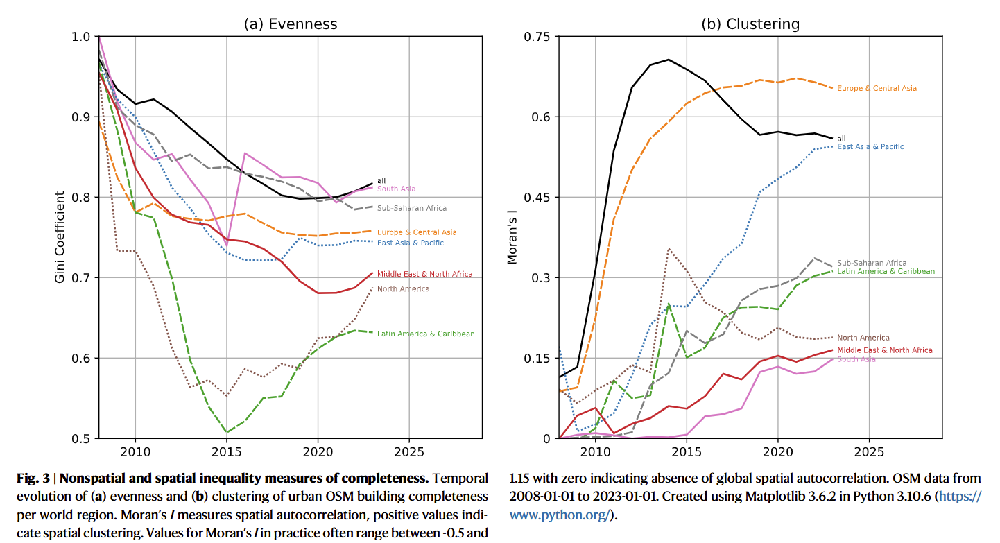
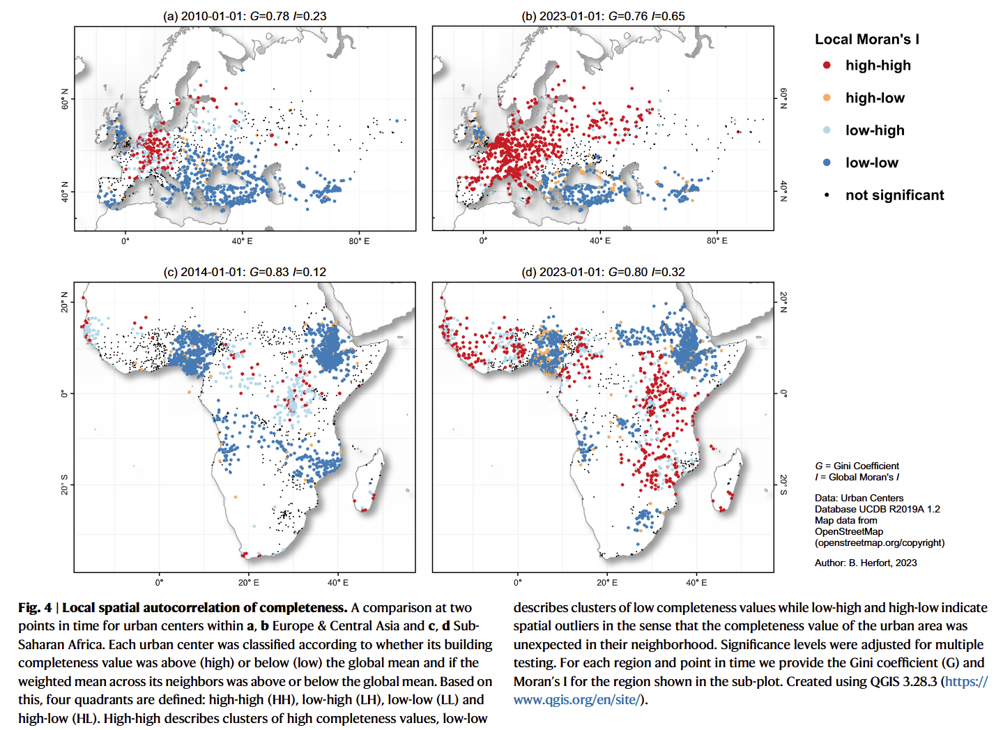
- Spatially clustered completeness pattern became less intense
Coding Reference:
