Objective:
- There is still relatively scarce research providing holistic, global and comparative understanding of the role of natural barries on urban outcomes
Case:
Methodology:
- Share of barries index
- Average nonconvexity index
- Detour index
- Robustness
- change radius
- data triming
Data Source
- People-based
- Global human settlement urban centres database: GHS-UCDB
- Building-based
- Spatial expansion of 200 cities: AUE
- Urban areas: GHUB
- Multitemporal global urban boundary: GUB
- Water bodies: Water Body Multitemporal
- Slopes: NASA Shuttle Radar Topographic Mission (SRTM)
Findings:
- Cities with a high share of barriers are predominantly situated in Central, East and Southeast Asia, and Southern Europe
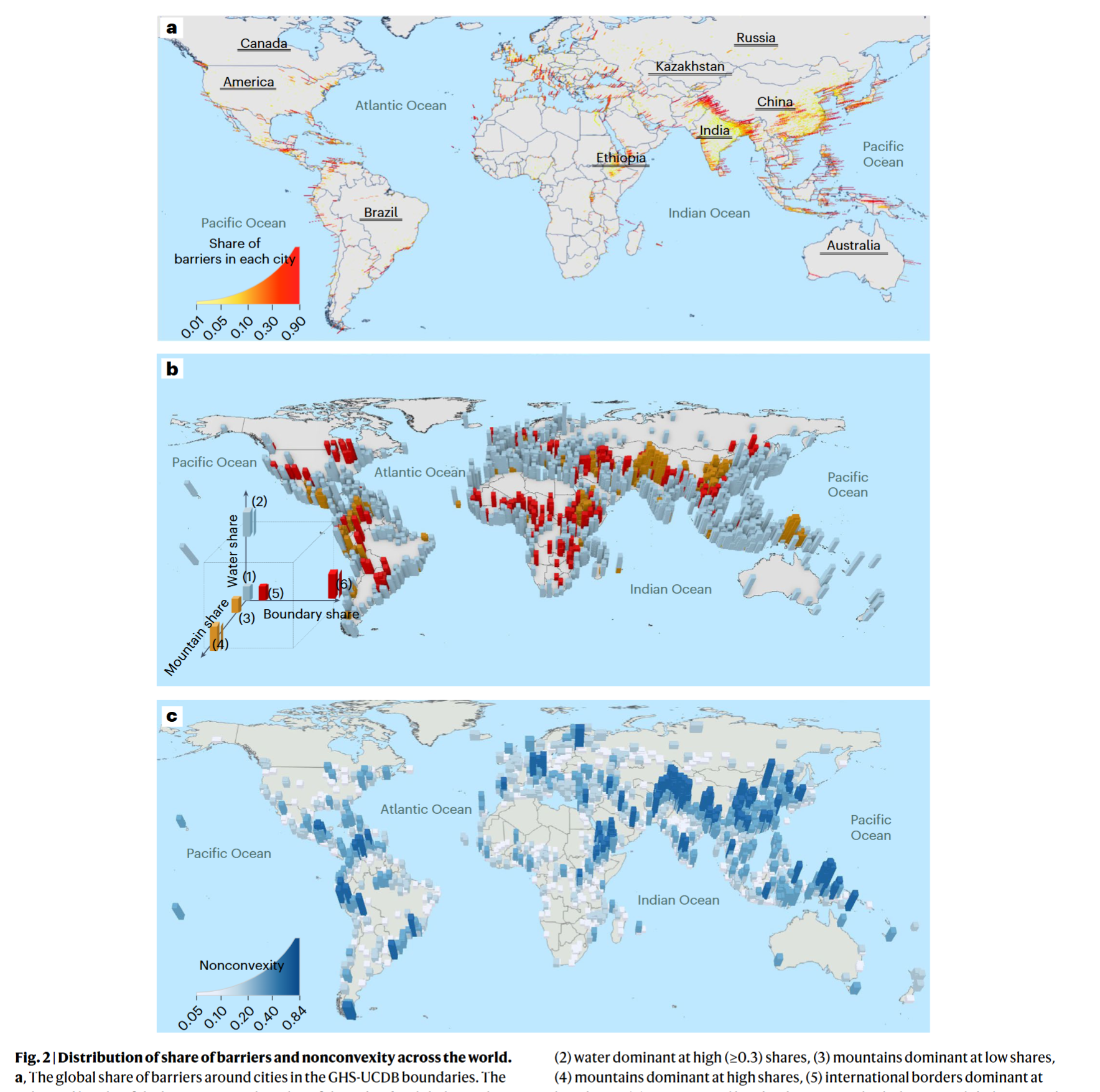
- Most cities impacted by geographical barriers lay near the ocean
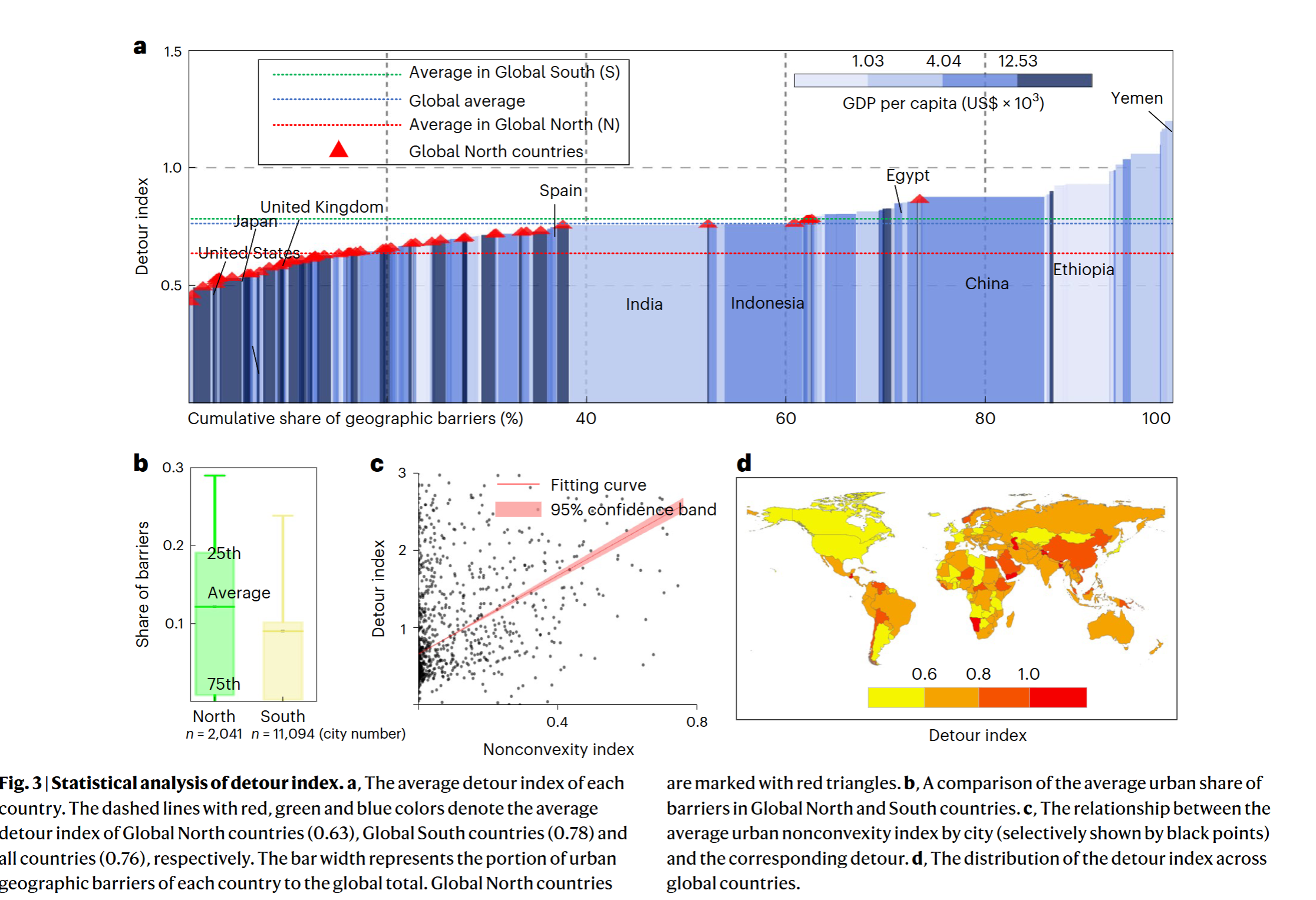
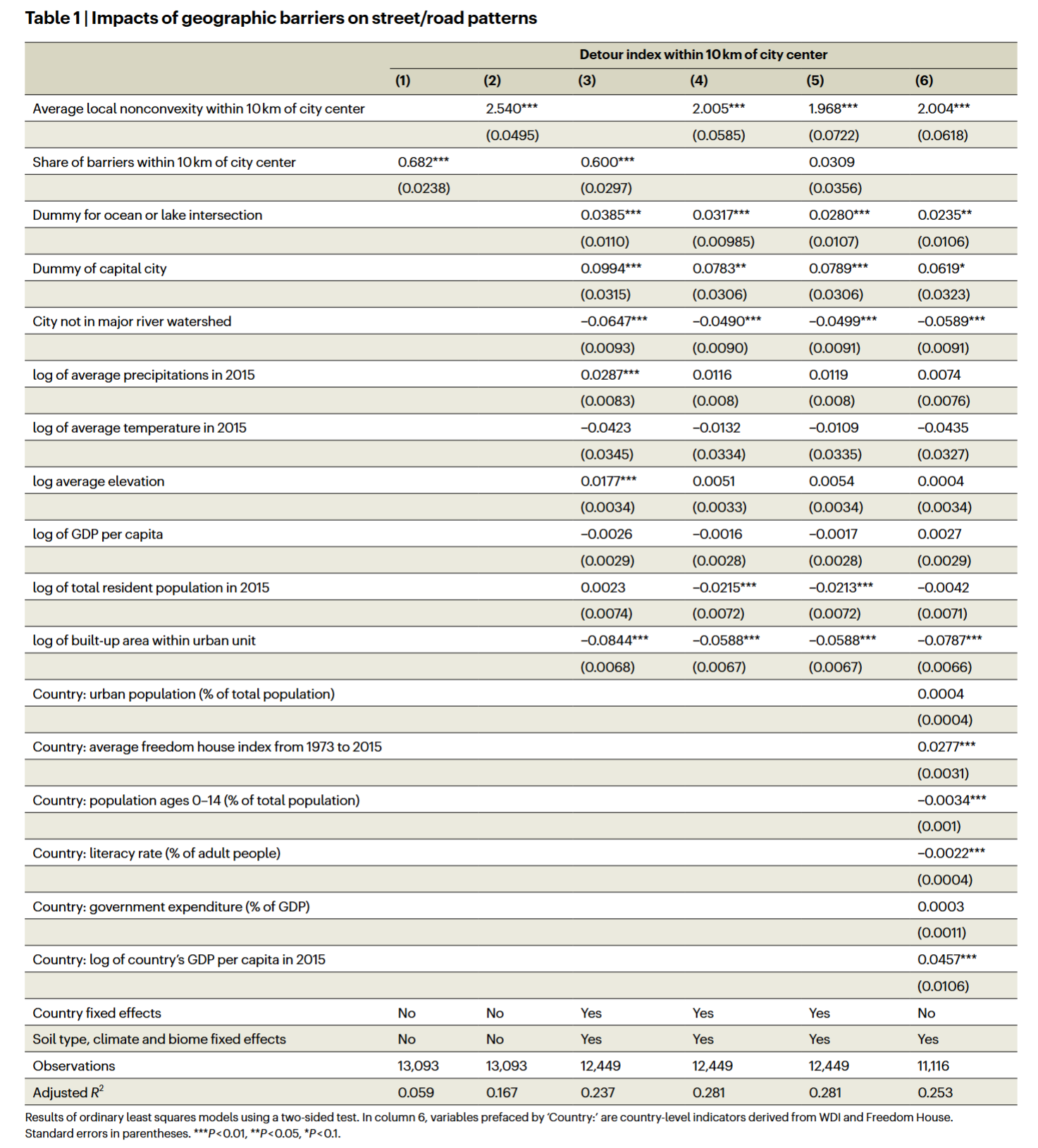
- Geographical constraints have an impact on road distances between points; however, barriers that generate nonconvexities display strong effects
- Dry places with no rivers and low precipitation tend to feature shorter-distance road trips
- Road distance tends to be lower in high-income countries
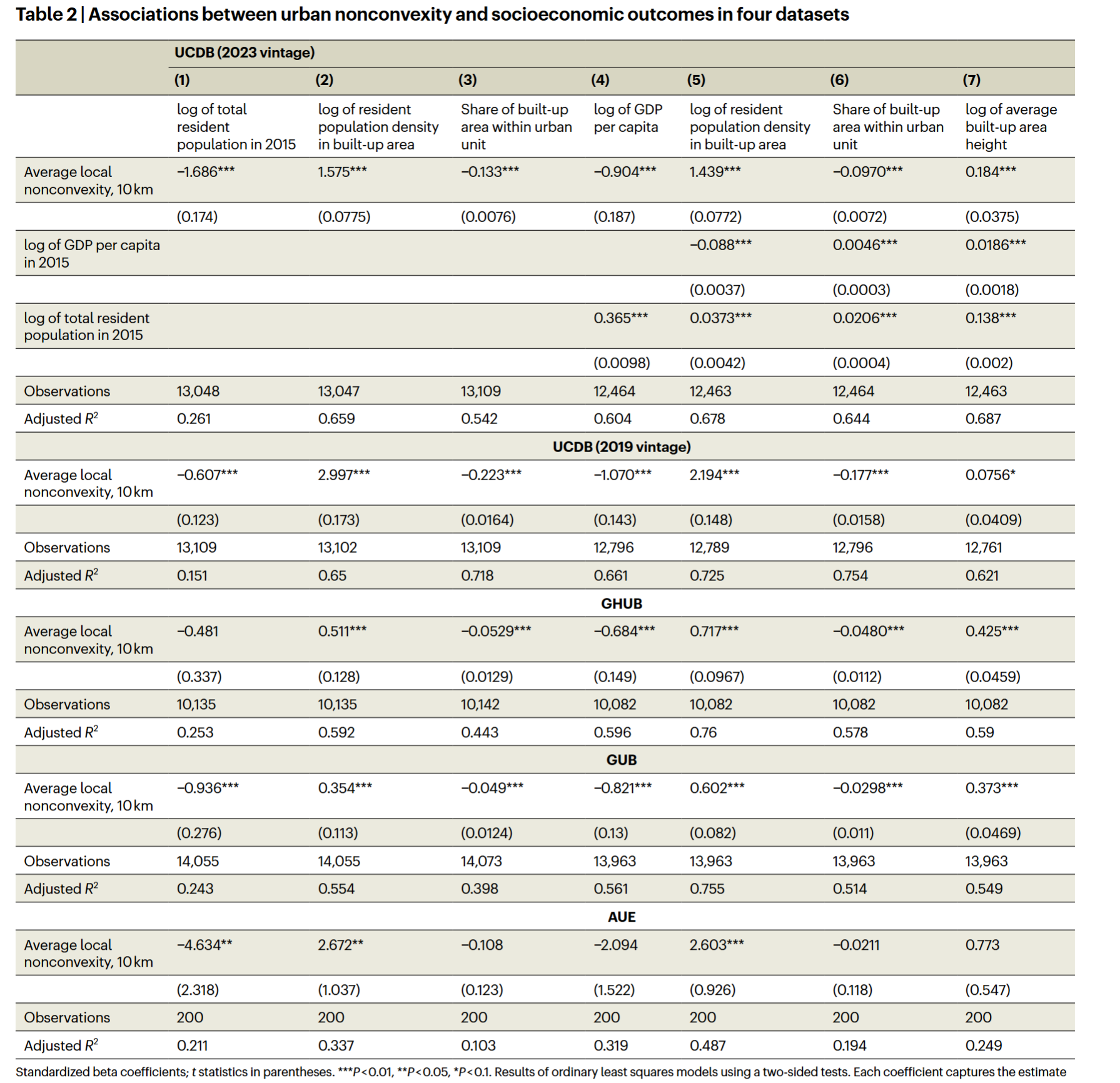
- A move across the 50th-90th percentile in barriers is associated with 14.5% higher urban densities, it’s also related with a reduced built-up imprint as a percentage of the urban area
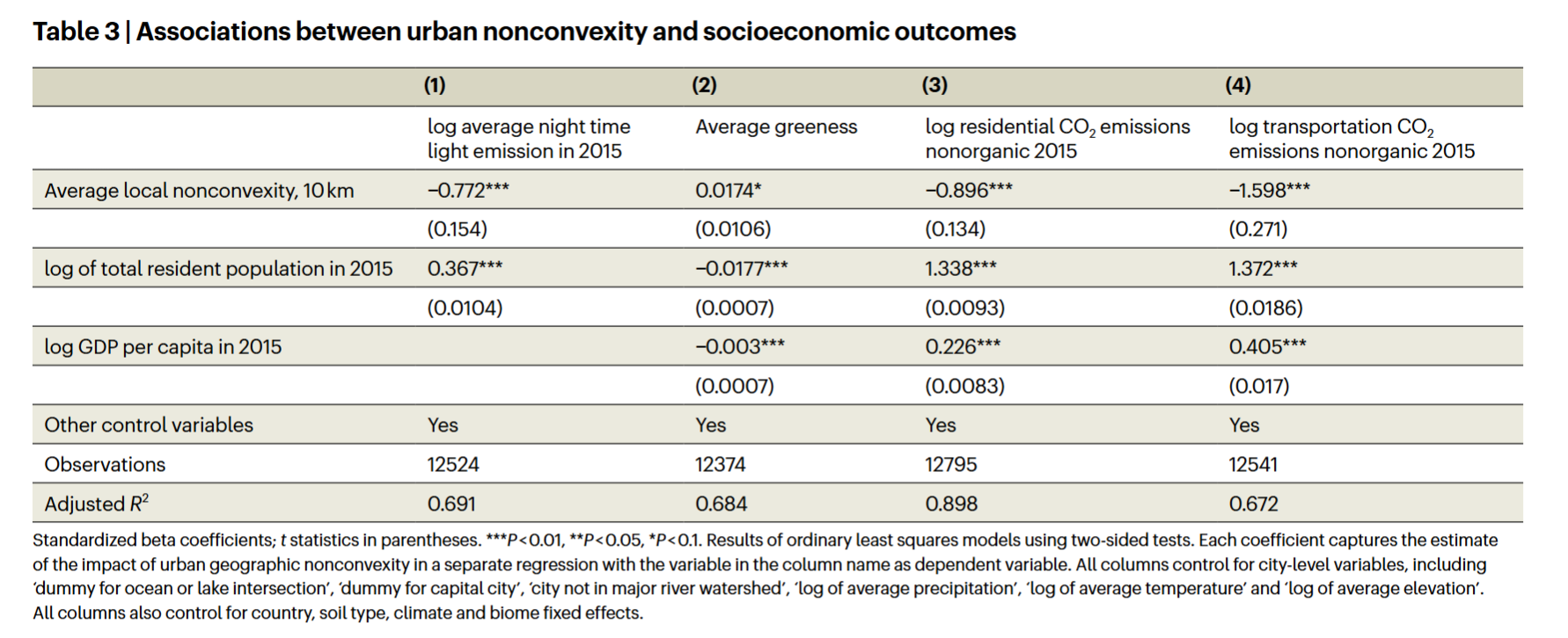
- Geographical fragmentation in and around cities to be associated with lower GDP per capita
- Topographical land fragmentation is associated with reduced urban night lights
Coding Reference:
