
Cattaneo, Andrea, Andrew Nelson, and Theresa McMenomy. Global mapping of urban–rural catchment areas reveals unequal access to services. Proceedings of the National Academy of Sciences 118.2 (2021)
Objective:
- Provide a spatial representation of urban centers and their catchment areas, emphasizing the interconnection between them
Case:
- Global grid
Methodology:
- Urban hierarchy: access to services and employment opportunities from rural locations
Data Source
- Data: URCAS from GHSL
- Access to cities in 2005: Global map of Weiss et al. (2015)
- Boundary: GAUL
- Income: World Bank
Findings:
- Review: the influence of an urban center as functional areas, functional economic areas, functional economic regions, city-regions, functional urban regions, local labor market areas, travel-to-work areas and functional territories
- Theory: Central place theory, relative space
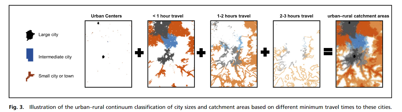
- Urban center: defined by a continuous grid with a densily of at least 1,500 inhabitants per km2 or a density of built up greater than 50% and a minimum of 20,000 inhabitants (followed GHSL)
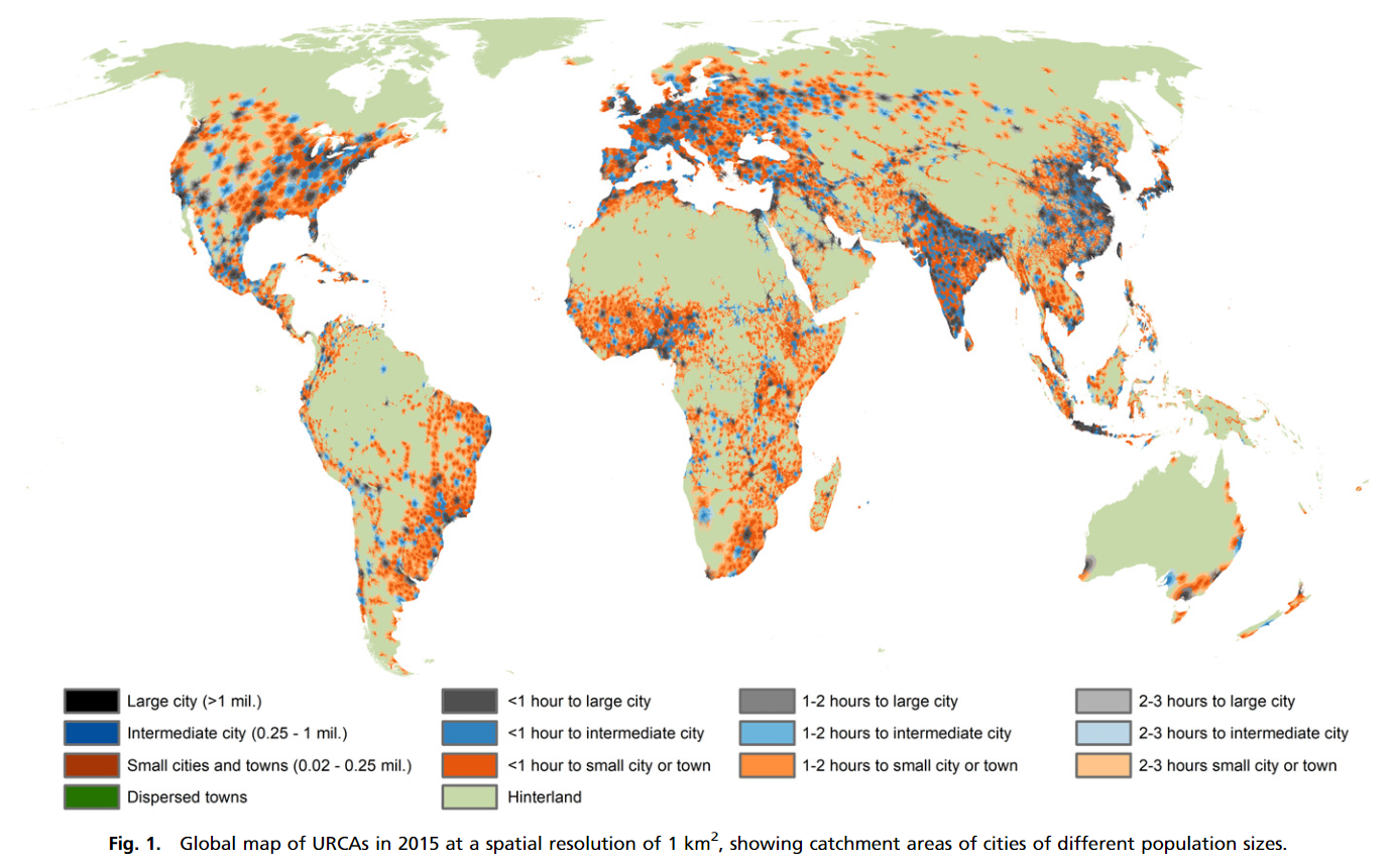
- Small cities and towns dominate large parts of the Americas, Europe, and sub-Saharan Africa, whereas larger cities are more prominent in the densely populated regions of Asia
- Less than 1% of the global population lives in the rural hinterland, more than 3 h from an urban settlement of 20,000 people or more
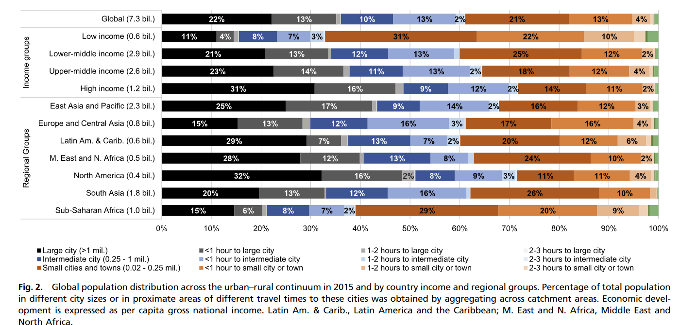
- A large share of people living in periurban areas, not just of large cities but also, intermediate and smaller cities and towns; in low-income countries, nearly 30% of the population lives in a periurban area of an intermediate or smaller city/town of at least 20,000 people
 </center>
- Rural population tend to gravitate less than proportionally around large cities
- Small and intermediate cities play a prominent role; less than one-third of the global rural population gravitates around large cities
- In low-income countries, the urban-rural profiles is dominated by small cities and their rural catchment areas
- In high-income countries, more people live in low-population density areas than in high-density settlements in the rural catchment
Coding Reference:
- Not applicable